Showing posts with label boat trips. Show all posts

Tuesday, October 31, 2017

Liberty Park Anchorage to Milford

Sunrise over Lady Liberty and Manhattan
United Nations Headquarters
Colorful factory along East River
Stepping Stones Lighthouse off Great Neck, NY
Tug and Barge
      Rested but apprehensive about my trip up the East River I awoke early and was underway by 6am. By leaving this early I knew I had plenty of time to reach Hellgate on the East River at or just after slack water which was at 7:36am. Heading out under a mostly cloudy sky, I passed the Statue of Liberty as Lower Manhattan and the Battery came into view. At this hour of the day there was limited water traffic which made for a much more relaxed cruise across the Upper Bay, past Governors Island and into the East River. I meandered about in the lower East River between Manhattan and Brooklyn awhile, passing by ferry terminals for Staten and Governors Islands, the South Street Seaport, then the Brooklyn Bridge. Then Puffin passes under 3 more suspension bridges- the Manhattan, the Williamsburg and then the Queensboro which places me between Upper East Side and Roosevelt Island, just past the United Nations Headquarters, traveling at about 8 mph. By about 7:45am, the sun had come out to stay.  About 8am I have passed Hellgate and am now on a flood tidal current,  aiding my trip into Long Island Sound: speed has picked up to 9 mph with no change in throttle. Shortly I pass between North and South Brother Islands and put Rikers Island to starboard. By 8:40 Puffin is past Whitestone Bridge and by 9am she has passed under Throgs Neck Bridge and out of the East River into the western end of Long Island Sound. By getting the timing right on current ebb and flow past Roosevelt Island and Hellgate, the whole East River trip was a pleasure instead of a white knuckle ride on turbulent waters in my slow sailboat.
Execution Rocks Lighthouse off New Rochelle, NY            
By 9:15am, I was passing Manhasset Bay to starboard and Hart Island to port. As I worked my way eastward, I passed by several lighthouses marking shoals, ledges and islands; the occasional tug and barge, numerous pleasure and recreational fishing boats, a windjammer, and commercial clammers, draggers and fishing vessels. All in all a very pleasant day. I motored into Milford, CT at 4:15pm, a 10 hour 15 minute run of 55 nautical miles (63.3 statute miles).

Great Captain Island Lighthouse off Greenwhich, CT
Next leg of journey will be to Point Judith and Wickford, Rhode Island.


Penfield Reef Lighthouse off Fairfield, CT

Friday, September 22, 2017

Hudson River Alone-Coeymans(New Baltimore,NY) to Haverstraw Bay

Roundout Lighthouse
Tanker Palanca Montevideo   


Esopus Meadows Lighthouse   
Galleon Replicas    
Bannerman Castle/ Arsenal
Pete Seeger's Clearwater
At Coeymans Marina, I (Suzan) jumped off Puffin and headed home by land to Massachusetts leaving Dean to captain alone the mighty and sometimes rough Hudson River to and around New York City. So, July 10th, heading out of Coeymans with a 5 to 7 mph wind on the nose, Woodstock, the cat and I (Dean) had a pleasant trip down to Roundout Creek and the Hudson River Maritime Museum and Boatbuilding School. About two hours into the trip I spotted 5 deer playing and grazing along shore. A bit further along I noticed a bald eagle and blue heron standing on the shore right next to each other, which I thought to be kind of curious, like a couple of fishermen discussing tactics and gear. Periodically a tug and barge on water or AmTrak or freight train along either shore would pass by, whistling it's approach. We made 41 statute miles that day. Once secured dockside in Kingston I took the bike into town for some sightseeing and groceries. The following morning I was underway downriver at 6am. Ten minutes later Puffin was exiting Roundout Creek, passing Roundout lighthouse and back into the main body of the Hudson River. About a half hour later I'm passing Esopus Meadows lighthouse, warning of a large area of shallow flats at a bend in the river. Just off the town of Hyde Park on the eastern shore, on the charts, is an anchoring ground for vessels awaiting loading or unloading. There sat the Palanca Montevideo, a 182ft asphalt/bituminous tanker, obviously awaiting loading as she sat very high off the water. Another large tug and barge passed by creating a wake which sent Woodstock scurrying below decks. Shortly a breeze sprang up creating ripples across formerly placid waters as Newburgh came into view, where two black Galleon style ships like the Nina and Pinta, appeared to be taking on passengers. Next Woodstock and I passed by Bannerman's Castle on Pollepel Island. It is a Scottish style castle/ armory and residence, built around 1900 by Francis Bannerman for safe storage of his company's munitions and war materials and a summer residence. A little further downriver we pass by West Point, home to the US Military Academy for the Army, perched on a plateau above the river. It is the oldest continuously occupied military post in the US, established by George Washington in 1775. About an hour later off Peekskill I noticed a large sloop that looked like Pete Seeger's Clearwater, which, it turned out to be! The Clearwater, a replica of the sloops sailing the Hudson in the 18th and 19th centuries was created to bring attention to the toxic chemicals, raw sewage and oil pollution fouling Pete's beloved Hudson back in the 60's and 70's, decimating fish populations along much of it's length. It made me happy to see she was still at it. Pete and his boat have been very successful. You can now fish the entire length of the Hudson though one must still be very cautious of what you eat from the river. That afternoon I decided to drop anchor in Haverstraw (Half Moon) Bay. 56 miles this leg. It had been a hot sticky day so after a light dinner, just before dusk, I took my first swim since starting the trip-much of the water having been to muddy or the weather to cool or rainy. The water was so cool and refreshing, I went back in several times before turning in after a beautiful, peaceful sunset.

West Point Military Academy  


Sunset Haverstraw Bay
.


Wednesday, August 23, 2017

On the way flowing up/ flowing down

Signage at each lock   
The Champlain Canal which runs from the Hudson River to Lake Champlain, flows south towards New York City from Ft. Edwards, the high point (Lock 8). Then flows  north to Lake Champlain through the last 3 locks. It climbs 139 ft. over the 42 miles between Troy lock and lock 8, then drops 44 feet to Lake Champlain. The upper Hudson is very narrow with falls and rapids so locks are needed to adjust the water levels for navigation. Fort. Edwards is the end of the navigable Hudson, which splits off and heads west while the canal continues north.

After spending several days and nights at Chipman Point Marina over the July 4th Holiday weekend, we are finally on our way through Champlain Canal and down river to Albany,  NYC and beyond.www.canals.ny.gov
As mentioned, we tried to go through Lock 12 at the Lake Champlain end of the canal on Sunday, July 2, to no avail. By end of day on July 2, most of the 3 Canals-Erie, Oswego, Champlain, were closed due to heavy rains, rising water and flooding. We have pictures going down the Canal where rising waters left muddy sludge on the shrubbery along the banks up to 5 feet above normal water level.
So---Tuesday, July 4th, 3 boats started from the Marina to begin navigating the 12 Locks of the Champlain Canal. Along the Canal in small towns, there are town docks, some with facilities, some not, where you can tie up at the dock for no charge. Several town docks had pretty parks and nice facilities.
Our first stop was Whitehall town dock, just beyond Lock 12.  A relatively new town dock with free water and electricity provided for transient boats.  Police station and fire department are just up beyond the dock, so very secure. We headed first to Historic Grounds, an awesome breakfast and lunch restaurant in an old bank building dating back to early 1900's, a short walk across the green.   Dean had eaten there in his way up to Lake Champlain and wanted to return.  We were able to shower at a restroom facility, built by the state of New York and taken care of by the town. We visited the Skenesborough Museum (Skenesborough was the original name of Whitehall) and wandered the town a bit waiting for lower locks to open. Across the Saunders St. bridge was a quaint shop in the old newspaper office - The Times Emporium. Both Historic Grounds and Times Emporium owners chatted with us about the town history and refurbishing being done to revitalize the town. We walked several blocks away to get some groceries and discovered a gas station there selling diesel fuel for a good price so I made three bicycle trips (for the exercise of course and something to do while waiting lock openings) to fill my single 5 gallon fuel can and the boat tanks - the jerry can fit neatly into a large backpack so was easy to carry on the bike.

As soon as the locks were open below 8 we were on our way to Fort Edward, below Lock 8.  Again to tie up at their town wall to wait for the lower locks to open. Here we enjoyed a wholesome, inexpensive meal at Ye Old Fort Diner, making it the third meal I (Dean) had here. Down on the dock we met other Canal travelers either going north or south that were held up for Lock openings. Next stop- Mechanicville and below now that locks 1-7 were opened heading us to  Troy Federal Lock and down past Albany.

Reason for the Locks seen
from inside the lock 
Mechanicville also had free hookups for water and electric, new bathrooms and showers. These features certainly help make the transit more economically feasible for many boaters. Here we walked to a Price Chopper nearby to replenish food supplies.
The following morning we were heading south again.

Mount Travers ahead 
At Albany, we were approaching a large ship, the Mount Travers, just pulling out of an Albany Commercial terminal maneuvered by 2 tug boats pushing and pulling the huge freighter. The captain radioed us that he would be moving slowly at first through the terminal area then gathering speed and asked at what speed we traveled. We radioed back that we traveled at 7 knots so he would be passing us at some point and would keep an eye out to give way.
Puffin at Coeyman's Marina  

Just below Albany we docked at Coeyman's Marina so 1) I could jump off and travel home by land as the Hudson River down and around NYC gets a little rough and 2) so a friend from the Albany area could visit.
As we were on the way home from the trip- Dean being on the boat for 45 days, at this point, and I for 30, I was ready to be on land for a while, not sure if Dean was and it would take him another week to reach south coast Massachusetts,

Locking Through  
Suzan and Puffin in Whitehall  


Sunday, August 6, 2017

Essex down to the start of the Champlain Canal south of Chipman Point Marina

Residence in Essex, perhaps an old
 school house?
Essex, New York is a pretty town with many antique and architecturally interesting buildings. Unfortunately we arrived on a Sunday, part of the marina docks had been damaged due to the recent heavy rains, and numerous businesses were closed. We did find a restaurant - "Old Dock House Restaurant and Marina" for a pleasant dessert.

Vergennes
Otter Creek
From Essex Harbor we traveled across the Lake to the eastern shore (Vt) and 7 miles up Otter Creek to the delightful little town of Vergennes, a hidden gem. We tied up at their town dock, no facilities (restrooms, showers, or fuel) other than electric We could walk up a small hill to their main street, shops, restaurants, convenience stores and town offices. The night we arrived, we met a couple who lived aboard their 38 ft Kadey Krogen boat, and attended the town's Strawberry Festival that evening. We stayed 2 nights in Vergennes again due to weather, and started back down the Lake heading for the Champlain Canal to take us to the Hudson River, around NYC, and home to  south coast Massachusetts.

Early Sailing Canal Schooner  
Philadelphia
Next stop was Basin Harbor  and Resort, home to the Champlain Maritime Museum with a working revolutionary war gunboat replica, the Philadelphia and the  Lois McClure, a replica of an early sailing canal schooner, currently sailing and boating through the Champlain and Erie Canals to Buffalo to celebrate the 200 year Anniversary of the initial construction of the Erie Canal in  1816. See more at www.canals.ny.gov.    At Basin Harbor one can tie up at their courtesy Dock to explore the Museum and dine at The Red Mill restaurant. Interestingly, the restaurant sits beside a small airfield where patrons of the Resort and restaurant can land a small plane and stay for awhile. The Resort reminds us of the Resort from the Dirty Dancing movie. Although the Dirty Dancing Resort was located in New York Catskills, just sold and is to be demolished.
We moored overnight in Mile Cove, just North of Basin Harbor.
We continued our journey south passing the Crown Point Bridge ( Lake Champlain Bridge) and one of International Paper Company's mills,www.internationalpaper.com largest in the world for their type of product ( corrigated paper for packing and other packaging products.
From there we continued to Chipman Point Marina www.chipmanpoint.com, meeting our boater friends with the Kadey Krogen.

Chipman Point Marina     
Unfortunately most of this trip (over 1,000 miles) had  more rainy, cloudy days than sunny. We arrived at the Marina on a Thursday, hoping to make Lock 12 on the Champlain Canal on Saturday. We were convinced to stay Saturday night as the Marina was hosting a Pig Roast and Fireworks for the July 4th Holiday weekend. Again, it rained off and on Thursday, Friday and continually for 5 hours on Saturday cancelling the Pig Roast. The up side is that it cleared by early evening and the Fireworks put on by the Marina Hosts, Pat (female) and son Chip were fantastic.
By Sunday, we were out to the Canal, checking their site for Lock closures due to the heavy rains and rising water. As we approached Lock 12, the falls were roaring and high. Most Locks are placed where there is a waterfall of some height or rapids and shallows, making it impossible for a boat to travel through. We called the Lock as we're approaching, and were told that most of the Canal was closed and there were boats hanging between lock 7 and 8 as the lower Locks were closed also.  The Champlain, Erie, and Oswego Canals were closed for 3-4 days until the water levels lowered and debris was washed aside. We turned and stayed 2 more nights, until July 4th at Chipman Point Marina. We had traveled 3 hours to Lock 12 and 2 hours back to the Marina. The current was with us on the way back so we were cruising at 10 mph., 3 mph faster than our usual 7 mph. By this point, we needed to replenish our food supply, water, fuel, and get a pump out. Our Host, Pat, offered her personal car, so we could drive to the market for food supplies.
A note on measuring mileage on the water: inland waterways are measured by statute (land miles) and ocean and coastal waters are measured by knots(nautical miles). There is a small difference in the calculation.
Stay tuned for my Canal and  Lock experience.


Tuesday, July 25, 2017

Burlington, VT and beyond

Suzan along 1st St. Market Place
Burlington Harbor sailor
I needed a few days to recoup - mind you, this is my first boat journey and my first time living on a boat for more than an overnight. Living on a boat: our boat is 33 ft long and 10.2 ft wide, through much of it's length -  not bad. We get along in narrow spaces and really don't need our "own space". My issue is with the expanse of water with no or little land in sight as we experienced on Long Island Sound. I am learning through this journey that I need to set boat traveling conditions with the captain (Dean) i.e. I don't want to be far from shore.
I jumped ship at Shady Harbor Marina, New Baltimore, outside of Albany, unfortunately for me, just as we were entering calmer waters, canals, and locks. Dean had decided to continue alone and go through some locks up the Erie Canal before going back down to Waterford to traverse the Champlain Canal up into Lake Champlain.

Dragon boat
 After a few days to catch my breath and my will, (10 days) I was ready to resume my journey with Puffin, our boat and hubby/captain Dean.
 Mid June, I rented a car and drove to Burlington, Vt to meet up at Burlington Community Dock. As I had rented a car, we were able to grocery shop to replenish before returning the car at the airport. Then back to the boat via Uber.


Burlington/ Plattsburgh ferry
We spend a day touring Burlington, a vibrant college town, and then continued north on the Lake to see other spots. First stop was Malletts Bay, still on the mainland but bordered on the northwest by Grand Isle, also known as South Hero Island, with a nice inner cove to tuck in at Champlain Marina, one of the nicer marinas with full amenities including laundry/shower facilities. To get into Malletts outer Bay, you have to sail through an opening in the northern end of an old railroad bed no longer in use by the railroad, converted into a biking and walking trail on either side of the boat opening. We stayed 2 nights due to rain and thunderstorms. This entire journey has been marked with more weather related stays than sunny days. Then on to South and North Hero Islands, almost to the Canadian border. We stayed at North Hero Marina again tucked into a cove, Pelots Bay to be exact. Here again we had to pass from the main body of the lake via an opening in a former railroad causeway to enter the bay. We attempted to boat to Rouse's Point, on the Canadian border, alas, again, the weather predicted rain and thunderstorms for much of the day and the waves were kicking up so it was decided to travel down Lake Champlain along the western shore passing Plattsburg, around Valcour Island, an historic location and popular anchorage spot for sail and power boats.
Rugged shoreline above Burlington
From here, we ended the day in Essex Marina for an overnight.


Monday, July 3, 2017

Up to Albany, Troy and the start of the Canals


From NYC we traveled up the Hudson River about 33 miles from the Battery and stopped at Croton on Hudson (Half Moon Bay) for the night, as we had traveled rough waters- 3 ft waves up the Hudson with the winds and I was done for the day. A storm was brewing and I wanted to be in safe harbor.  Many other boats thought the same and we ascended on this Marina, probably 6 boats within 1 hour. We stayed 2 nights with the rain and wind. We passed West Point and the CIA (Culinary Institute of America) on our way up the Hudson River to Kingston, NY, docked at Roundout Creek, an inlet off the west side of the Hudson. Tied up to the dock and met a couple from Michigan, who live aboard  a 58 ft  trawler style boat named "Tinacious", that they designed and had completely  re-built themselves from a bare hull, a massive project.
 Riverport Wooden Boat Building School is located there and Dean was enjoying chatting with the boat teachers and students.  We stayed there for 2 nights (weather-rain) and walked into town for a meal with "Tinacious" owners, Art and Pam.

Last stop before Albany/Troy area is the Shady Harbor Marina, 10 miles south of Albany. There we met some Loopers we had previously seen at Half Moon Bay Marina and Kingston; and other boaters who recognized our boat from passing on the Hudson River.  There is a restaurant on site and you can chat and play outdoor games with fellow boaters.

It didn't seem possible that we were going to be able to meet with friends in Montreal due to weather related traveling. We needed to decide on an alternate path as part of the Erie and Oswego locks were closed for a short time with the heavy rains and we also heard about some issues with the Ottawa River .

By Friday, I decided I needed a break, after roaming what I called high seas -3/4ft waves, (from my non boater status), rain and wind. I jumped ship and drove to Massachusetts for a little regrouping. My anxiety with the weather led us (Dean) to decide to take the Champlain Canal to Lake Champlain where I can rejoin our journey.
Next one- Dean with the Canals, regrouping, and redirecting our trip.


Sunday, June 25, 2017

Some things to know


Boats- the type you choose is a big consideration.  Most of the Loopers (boats cruising the Great Loop or any part of it) we connected with had power boats a bit larger than ours.  Ours being 33 ft motor sailor with masts down, and 10ft 2 in width.  Some of the power boats, trawler style,  were from 36' to one we met from Marathon, Fl. a live aboard, at 58 ft, a bit larger than they had anticipated, to a 48 ft live aboard.  These couples no longer own land homes, their boats are their homes.  A little scary for me at present although, I would like to perhaps have a 36' ft trawler on the intercoastal down south.  And there were a few hard core sailing people making the Great Loop in their 40 some feet sailboats. One couple we met were from Finland and sailed to the US from there to travel the Great Loop.

Coming from South Coast Massachusetts down to NYC, there are many coves and tucked in harbors and marinas to spend the night, not much in anchorage or moorings. Many along the way to NYC charge from $2.50-3.50 a foot for dock space. We had to tuck into some of them as our weather beginning the trip was not ideal- much rain, wind, and high seas. We were able to get  free moorings with the town of Fort Washington in Manhasset Harbor but is was too windy and wavy for me that day so chose to go into a dock.  You can anchor behind the Statue of Liberty if the waters aren't too busy.
As you journey farther up the Hudson River you can find Anchorage and Moorings at least 50, 60 miles from the Statue. There are many areas to tie in the Canals or at a Lock with nice parks you can be on land for a while. 2017 is an Anniversary for New York so the NY State canal system is not charging for canal travel and tie up.

Marinas- Many of the larger and better equipped Marinas, especially on the Hudson River,  are very familiar with Loopers and welcome them. The boats traveling the Great Loop or any portion of it Triangle, Champlain Canal Loop, will spend $$$ for supplies, groceries, any boat repairs, restaurants, laundry, fuel, pump outs, at the Marinas with these conveniences. The dock fees range from$2.25/ft to less than $3.00/ft plus a few $$$ for electric. on Hudson River Marinas as you get up the river about 50 miles.  Sometimes the dock fee is worth it if you have been traveling 6-7 hours a day for a few days,  and need a shower and laundry, or a meal you did not prepare on a boat. Stay tuned for the Hudson River and the NYState Canals

Wednesday, June 14, 2017

East River around the Battery and up the Hudson

I know why it is called the Battery.  You get battered around by all sizes of boats, waves from the boats, tides, wind, and ebb and flood currents from the tides.  That is a mouthful and a boatload of obstacles to maneuver around. The weather was not the best, cloudy, though no rain, and some wind.
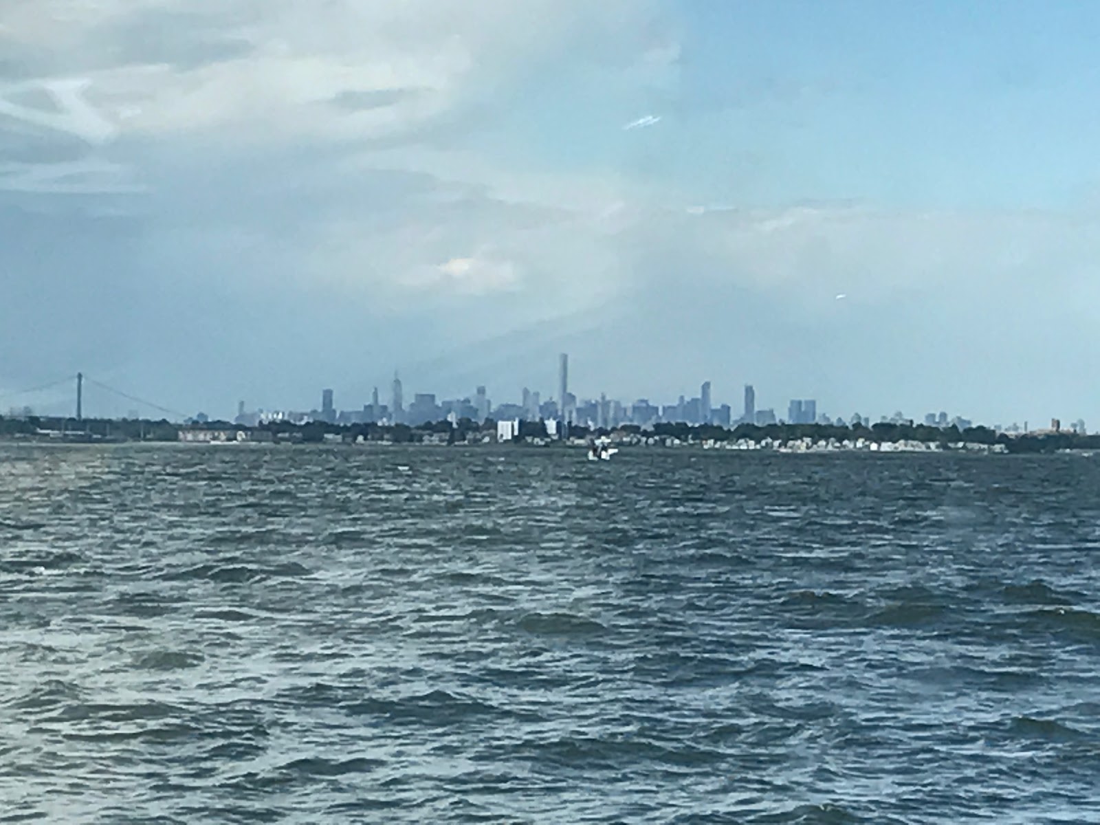
We started out from Port Washington, LI about 10:00 am so we could catch the currents at ebb on the East River from Hell's Gate- which is about the middle of a 14 mile run from Throg's Neck Bridge to Manhattan (the Battery). Eldridge's Tide and Current Book start at the Bridge 2 hours after low tide at the Battery. We had to calculate the low tide, 2 hours, and our speed getting to the bridge and Hell's Gate to figure how to travel with the ebb currents or fair current in East River the last 1/2 of the 14 miles. Ebb currents can work in your favor, carrying you 2-3 knots faster than your normal cruising speed. Catching the wrong current can put you up to that much slower than normal.  We tried to time our trip around Manhattan for flood currents in the Hudson River. That didn't quite work in our favor, but not too bad. To see Manhattan (NYC) from the water is something to behold!! The skyline mixing old architecture with new modernistic is incredible and a little weird.  There are many buildings higher than the Empire State Building especially the new 911 structure in downtown Manhattan. From the west end of the East River you can see the Statue of Liberty in all her magesty at the base of the city. Anchor behind it or moor in Liberty Park, on the New Jersey side.  We dodged tour boats, cruise boats, small and large, and many other boats, including Looper boats such as ourselves going up the Hudson to the Canals.  I am learning there are different routes(loops) to take on this journey.  Heading up the Hudson River was a challenge, with all the boats and the current not always with us. It wasn't against us that much, just chugging along.  We recognized other Loop boats we had seen or docked with earlier. Next blog-- journeying up the Hudson River with other Loopers and other routes to take.

From afar


New vs Old


Sunday, June 4, 2017

Stuck with the Weather.

We thought April showers bring May flowers.  Apparently not true according to the weather guy upstairs.  Just a challenge to my (Suzan) seaworthiness.  Started out last Wednesday with reasonably good weather.    Except when we were out in more open seas, we were rocking and rolling, as I call it.  Only made it past Padanaram Harbor and turned back into that harbor as I was not doing well with the higher seas.  Moored at the NBYC, nice with launch service. Looked at the weather on NOAA charts-- not good for a few days-- we (Dean) and Woodstock (our cat) moored for 2 nights.

Thursday morning I returned home we were only 10 miles away by land, 1 1/2 hours by boat. Had to regroup for weather , and this will not be the only weather regrouping.  I, not being a bonified boat person, choose not to ride the 2 ft waves.  Friday Dean brought Puffin back to the dock we started from and was out again to Point Judith and New London, Ct. on Saturday.  I, and the cat, opted to take a train from Providence to New London on Sunday to meet him in New London. I arrived at 1:30 and Dean had just fueled up at Burr's Marina. We stayed 2 nights at Crocker's Boatyard, closer to downtown New London. Nice Marina, family owned since late 1800's. www.crockersboatyardinc.com.                      

Out again on Tuesday after making a trip to Defender Marine in Waterford, next town from NL.

On our way, seeing how far Puffin motors in about 5 hours, quite a push for me, having been on the boat for only 2 hours traveling from home in over 2 ft seas.  We listened to the marine forecast and the seas were to be less than 1 ft and cloudy skies. We had a current with us for most of the 5 hours, pushing us at 8.5-9 knots so arrived at Branford, Ct . Our normal is 6-7 knots as we are a motor sailboat without masts and sails for this trip. we have a small inboard Diesel engine. Unfortunately we were at Branford for another 2 nights in a slip. We planned to leave around 10:30 am and the fog rolled in so we had to wait it out. Luckily it cleared by 12:30 and we were on our way to Stamford, a long hall, arrived about 5:30 -beautiful city, huge boats.


Off and boating the next day to Manhasset Harbor,  had a tough time with 3 ft waves coming into their harbor. We wanted a mooring, it was so windy and wavy that I opted for a dock. We are spending a lot of $$$ for docks/slips as moorings aren't readily available along the Connecticut and Long Island coasts.

Stay tuned for our journey down the East River, around Manhatten, and starting up the Hudson River.